

-
Via Agrippa in the Mürel
-

-
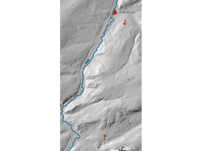
Ancient times meets high-tech: thanks to aeroplanes and laser scanners, the dead straight Via Agrippa, between the slopes of the Urft Valley and the Haubach Valley, is visible again. As the road on the Mürel ridge is now located in a forest area and is not marked by a conspicuous embankment, the course of the route had been lost in the meantime.
This changed with the laser scan from the air: some of the signals also reach the forest floor, so that after the trees are filtered out, a relief of the terrain surface emerges. In this way, a two-kilometre-long section of the Via Agrippa emerged, running straight south. Previously, the discovery of a strip of gravel debris, which had been noticed during geological investigations, had already indicated road construction measures there.
In 2009, archaeologists examined the ground. In doing so, they documented the remains of the road, possibly from two parallel routes. The reconstructed width of a stretch of road is an impressive 23 metres. Around 2.5 kilometres to the south, in the Blankenheim Olbrückwald forest, a section of the road of approximately the same width has been uncovered.