

-
Roman road on the plateau
-
-

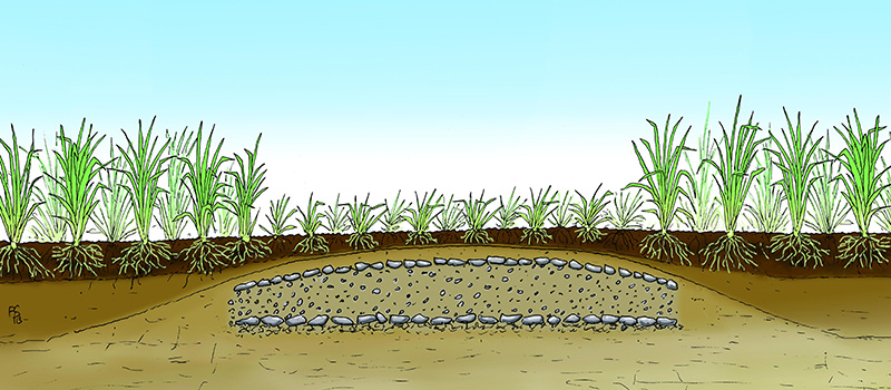
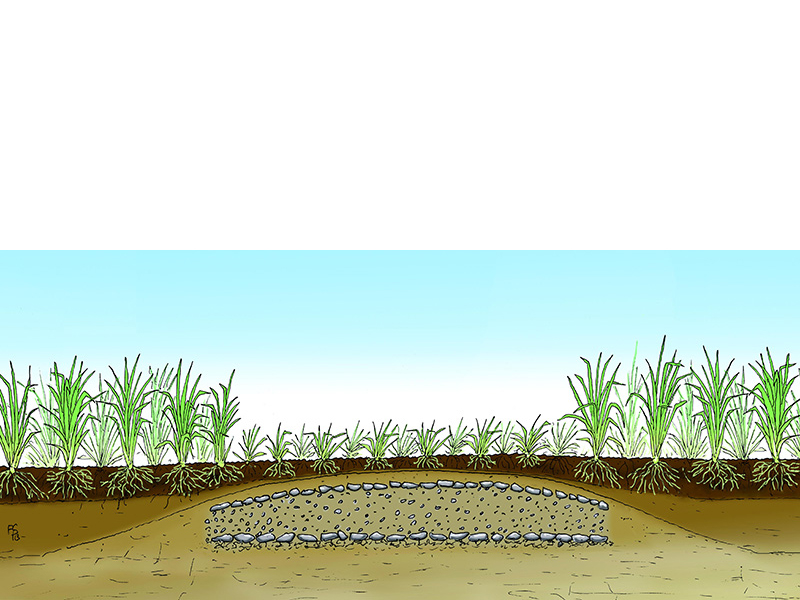
This is how one imagines a Roman road: from the southern slope of the Urft Valley to today's district road 59, the Via Agrippa ran straight as an arrow across flat land. From the air, it is still clearly visible as a light-coloured strip. This is due to the difference in vegetation: beneath today's surface, the gravel track of the Roman road still exists. The plants cannot take root as deeply there as they can in the loose soil to the right and left of the route.
The course of the road in this area can only be seen from the air. On the ground, the former Roman road is only faintly visible and, without the markings provided by trees, is hardly discernible to hikers.
Where the landscape allowed, the Roman road builders also built their routes as straight as possible in the mountainous regions, thus taking the shortest route between two destinations. They only had to make exceptions in the case of obstacles such as river valleys or hills. Further south from here, the route leads down into the Schleifbach Valley in a cutting. A branch of the road once climbed steeply up to the spur of the "Görresburg". It can be assumed that an alternative route ran at the foot of the hill, where the path can still be found today.