The modern road “Luxemburger Straße”, which runs for eight kilometres from Cologne following the ancient Via Agrippa in a straight line, turns south here. An archaeological survey conducted to examine the condition of the ancient road revealed that the Roman road was destroyed at this point, probably in connection with the fortification of the old B265. From here, the road “Industriestraße” leading to the Hürth-Knapsack chemical park follows the course of the Roman road for another 500 metres.
From the industrial park onwards, the ancient road gave way to the "Vereinigte Ville" open-cast mine until shortly before Liblar at the western foot of the Ville. The now recultivated site is a local recreation area whose lakes are relics of the former open-cast mine.
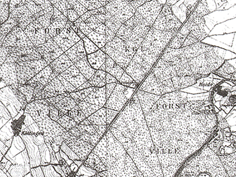
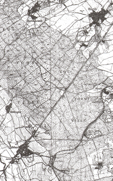
The course of Via Agrippa in this area can be reconstructed in its entirety with the help of historical maps, such as the French map of the Rhineland by Tranchot and von Müffling (1801–1828) or the Prussian maps from the 19th century.
The ancient route shows a barely noticeable bend at the highest point of the Ville. It is located near the late Roman fortification "Villenhaus" and may be due to a surveying error by the Roman road builders. From here, you can see both Cologne and Zülpich.