

-
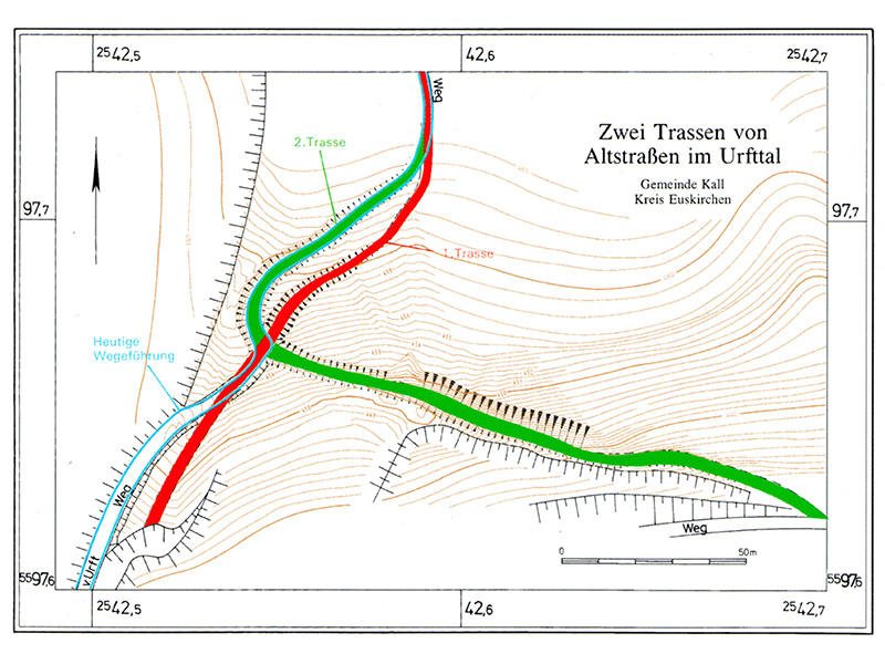
Via Agrippa in Kall
-
-
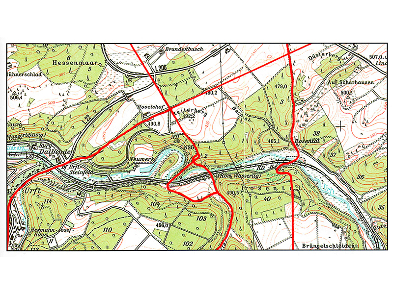
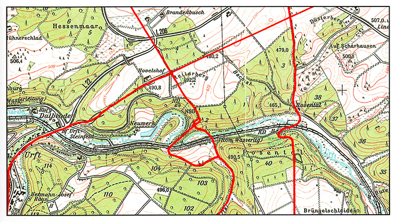
Uphill, downhill and winding several times: between Kall-Keldenich and Marmagen, the previously dead straight Via Agrippa split into two strands. They separated on the north side of the deeply cut Urft Valley and led down to the river on different paths. The eastern branch turned almost at a right angle after the fork and led diagonally down the slope, with a gradient of more than 20 per cent. To make this route possible at all, the rock had to be cut almost five metres deep – a difficult and tedious task.
The western route, which passes by here, headed more or less straight into the valley after the fork. It followed the narrow ridge of the spur that rises at the striking bend in the Urft. This section was significantly flatter, with a gradient of only 13 percent. After both routes had crossed the Urft in the valley – presumably via a ford – they merged again. From there, the Via Agrippa climbed up the southern slope and headed towards Marmagen on the plateau.
What is strange about this route is that the two routes crossed again shortly after they diverged ("spaghetti knot"). It is possible that the routes were built one after the other. Older maps only show the route in the east. However, it could also be that the flatter variant was only used for the more difficult descent. This was more challenging because a cart could slip despite its wheels being blocked and collide with the draft animals. On the ascent, on the other hand, additional animals (horse and cart services) could be harnessed to the front, thus allowing steeper routes to be managed.