

-
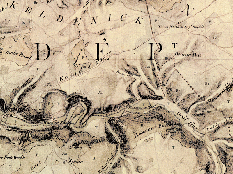
Roman road junction
-
-

Two roads that were still in use at the beginning of the 19th century once crossed at this point. The Via Agrippa ran from north to south, connecting Cologne with Trier via Zülpich. Another road came from the northeast, presumably from Wesseling on the Rhine via Euskirchen-Billig, the Roman vicus Belgica.
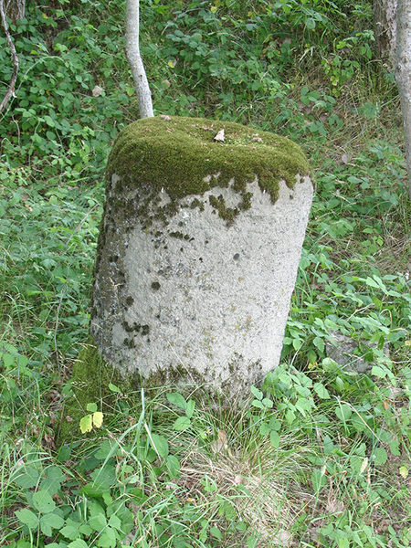
The road continued through the present-day villages of Urft and Marmagen, where the "Runde Stein" (round stone) has been preserved south of the village near the course of the road. This is probably the base of a Roman milestone. Its purpose was to inform passers-by how far away the next larger town or city was. This route is marked on a historical map from the early 19th century as the "Königstraße" (King's Road).
Some of the Roman roads were used for centuries. To this day, they still serve as roads, paths or trails in some places. For example, a dirt road still runs along the route of the Via Agrippa at this point. South of Marmagen, the two roads that crossed here merged to lead southwards together.