

-
Via Belgica in the Hambach open-cast mine
-
-
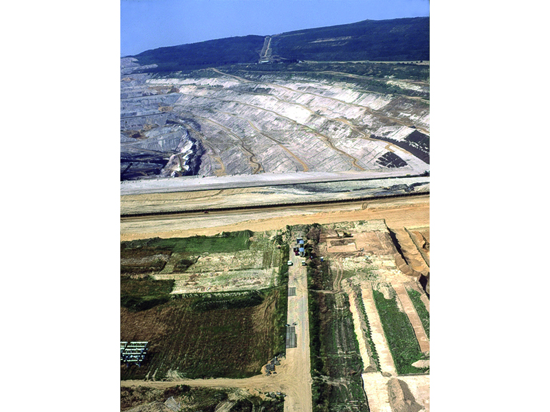
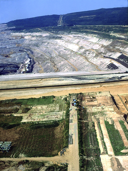
Since 1978, almost nine kilometres of the ancient long-distance road have been lost to the Hambach open-cast mine. This has enabled systematic archaeological investigations to be carried out: for the first time, such a long section of a Roman long-distance road could be intensively researched. The excavations and prospecting carried out until the end of the 1990s provided completely new insights into the ancient road system and the Roman settlement landscape.
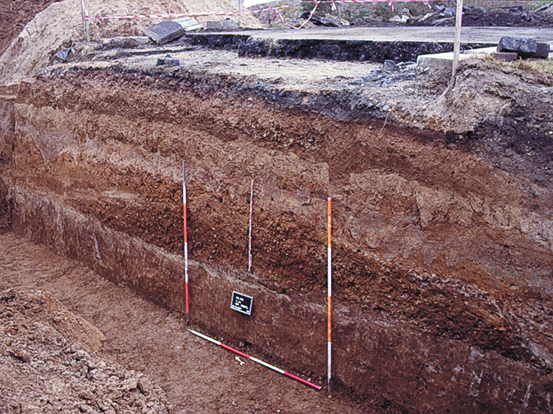
The structure of the ancient road was examined by means of numerous profile sections. The width of the entire road was approximately 25 metres from ditch to ditch. The gravel road embankment was about seven metres wide at its base and up to 60 centimetres thick. In addition to several phases of expansion and repairs, the tracks left by heavy carts were visible in many places. The embankment was lined on both sides by so-called summer paths, which were in turn bordered by road ditches on the outside.
The buildings along the edge of the road consisted of detached houses and farmsteads, whose grounds extended close to the road, as well as building complexes that were part of the transport infrastructure: a group of buildings near Eschergewähr, separated by a ditch, was probably a civilian road station where travellers could find accommodation and food. Archaeologists encountered a similar situation west of Steinstraß. The numerous graves on both sides of the Via Belgica were partly grouped in cemeteries and partly equipped with grave buildings. In addition, cult areas and fortifications were found. Overall, 20 years of archaeological research revealed a densely populated landscape along the Roman long-distance road.